The Las Campanas Petroglyph Site


While hiking around Las Campanas in 2014 I accidentally came across an extended site of petroglyphs to the east of the observatory. Although nobody currently at the observatory appeared to be aware of the existence of the site, it must have been visited at least once in modern times as the number "1965" can be found carved on one rock. This visit may have coincided with the site testing for and early history of LCO - if you have any information on this please let me know.


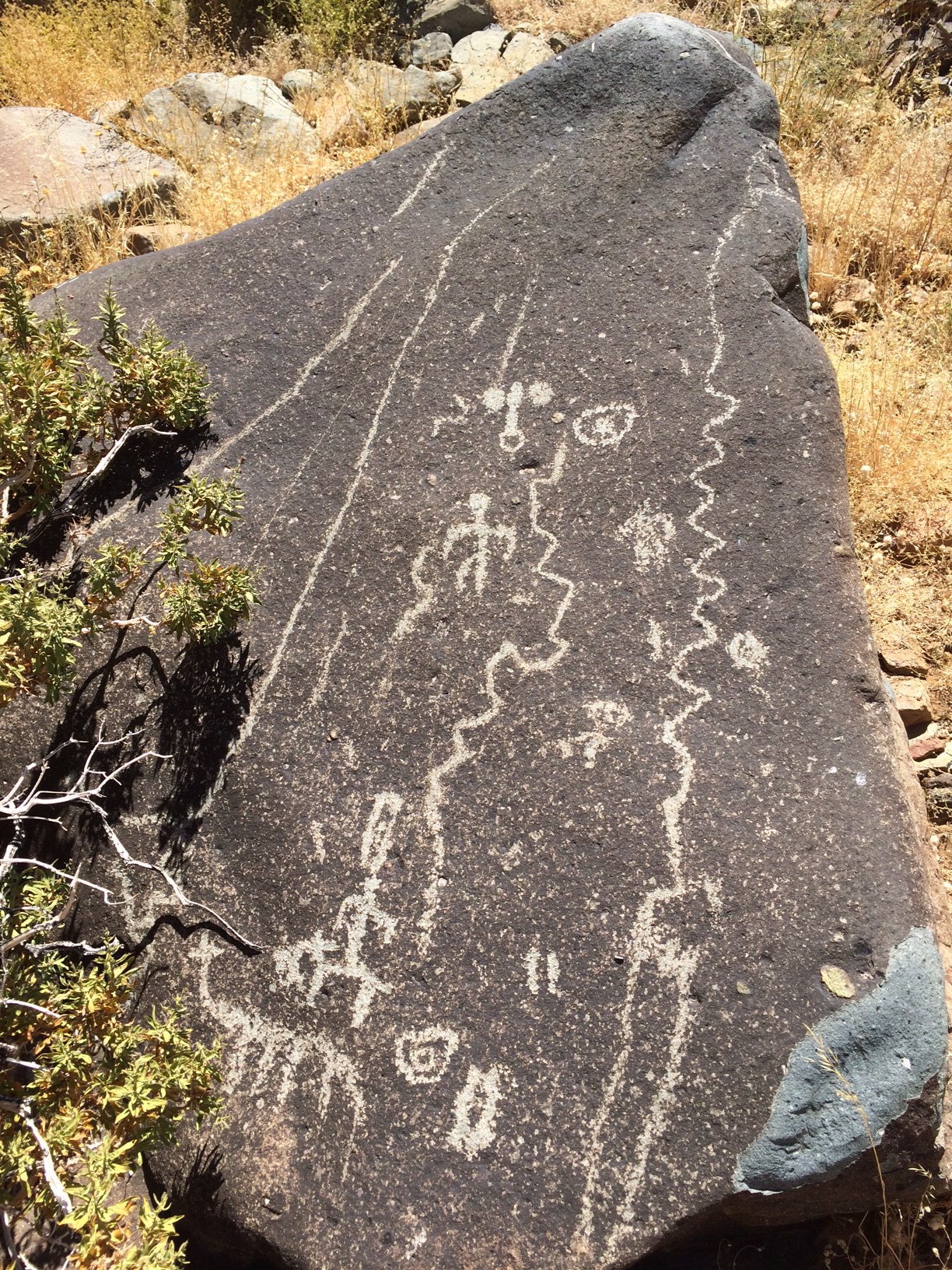
The petroglyphs are chiseled mostly on the east-facing sides of numerous boulders blackened by desert varnish. There are probably on the order of a hundred boulders with engravings, apparently dating from at least two different epochs. The older, paler petroglyphs (already weathered and recoated with a mineral layer) mostly show geometric symbols, snakes, lizards, sun disks. There is a fresher looking set of engravings, sometimes on top of the older ones, that often show Guanaco-like animals and human figures. The petroglyphs are apparently similar to those near La Silla Observatory, belonging to the Molle culture (700 A.D. ?).


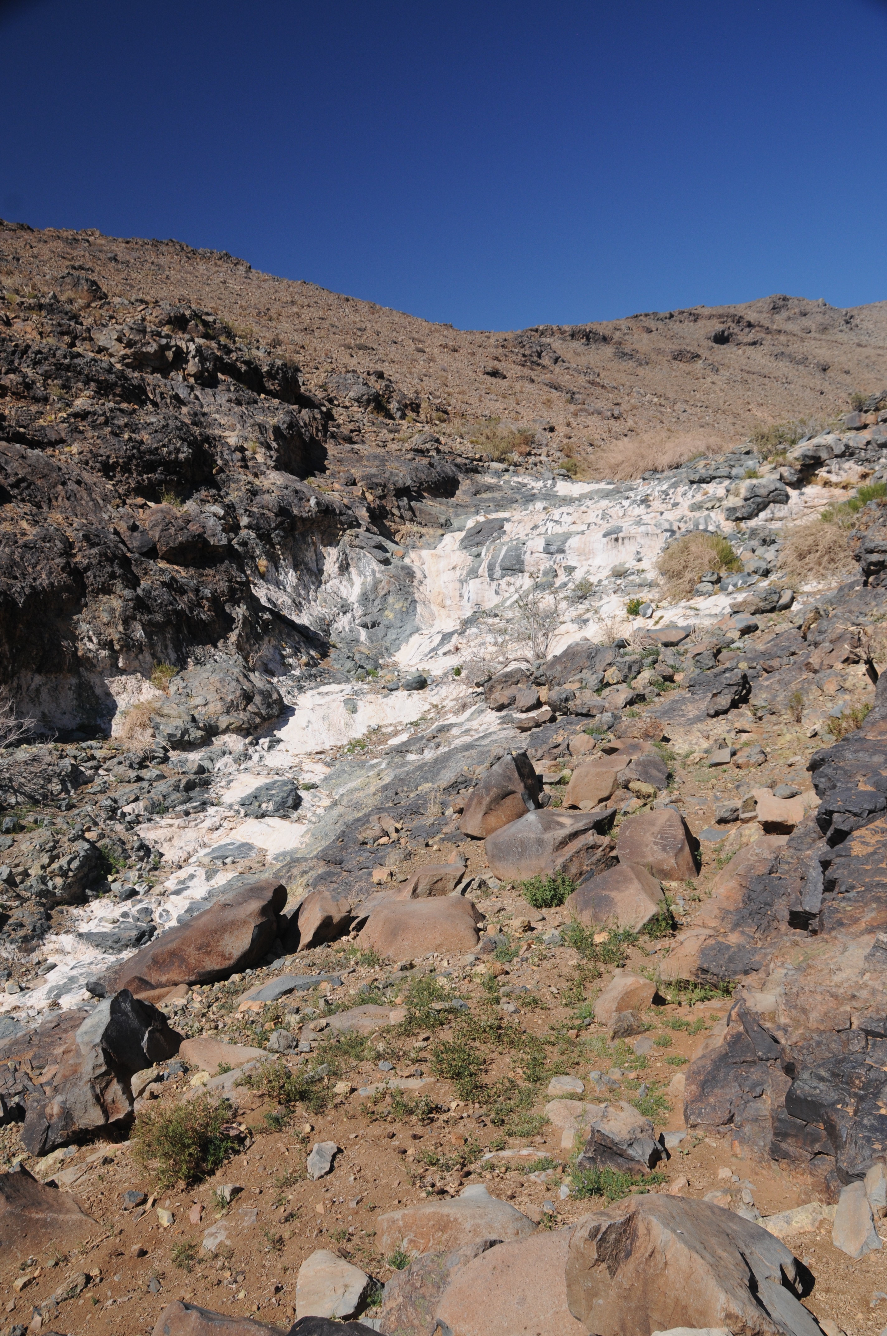
The boulders are to be found above several building foundations (or corrals ?) with primitive stone walls, adjacent to a mostly dry waterfall. The waterfall (in September 2014) was reduced to a pool of dirty, standing water. From afar, the calcinated, white rocks create the illusion that there is water gushing down the waterfall (which may be true for a short period during the rainy season). For a selection of photos of the petroglyphs, see the following link:

Las Campanas Petroglyphs, September '14


How to get there:

There is no path, but you can start walking downhill and east perpendicular to the road to LCO from anywhere between the solar telescope and the soccer field (roughly following the red line in the google earth image). Follow the steepest descent which will gradually form a little (dry) gully. You will be mostly walking on scree, and can make the trip easier on your feet by zigzagging a bit to the left (North) of the gully, following the occasional animal trails. Keep going down until you reach the dry waterfall (visible as a white spot in google earth images). By that time you will already have seen the first petroglyphs immediately to the left. They stretch probably at least 50-80m N-S below the black escarpment to the North (left when going down) of the gully. There are also some stone enclosures below the dark outcrops, several mill-stones, and a strange building (tomb? storeroom?) leaning against the cliff, consisting of a huge pile of rocks partly covered with soil, enclosing a chamber (see the two rightmost images in the top row of page 5 of the photo album.
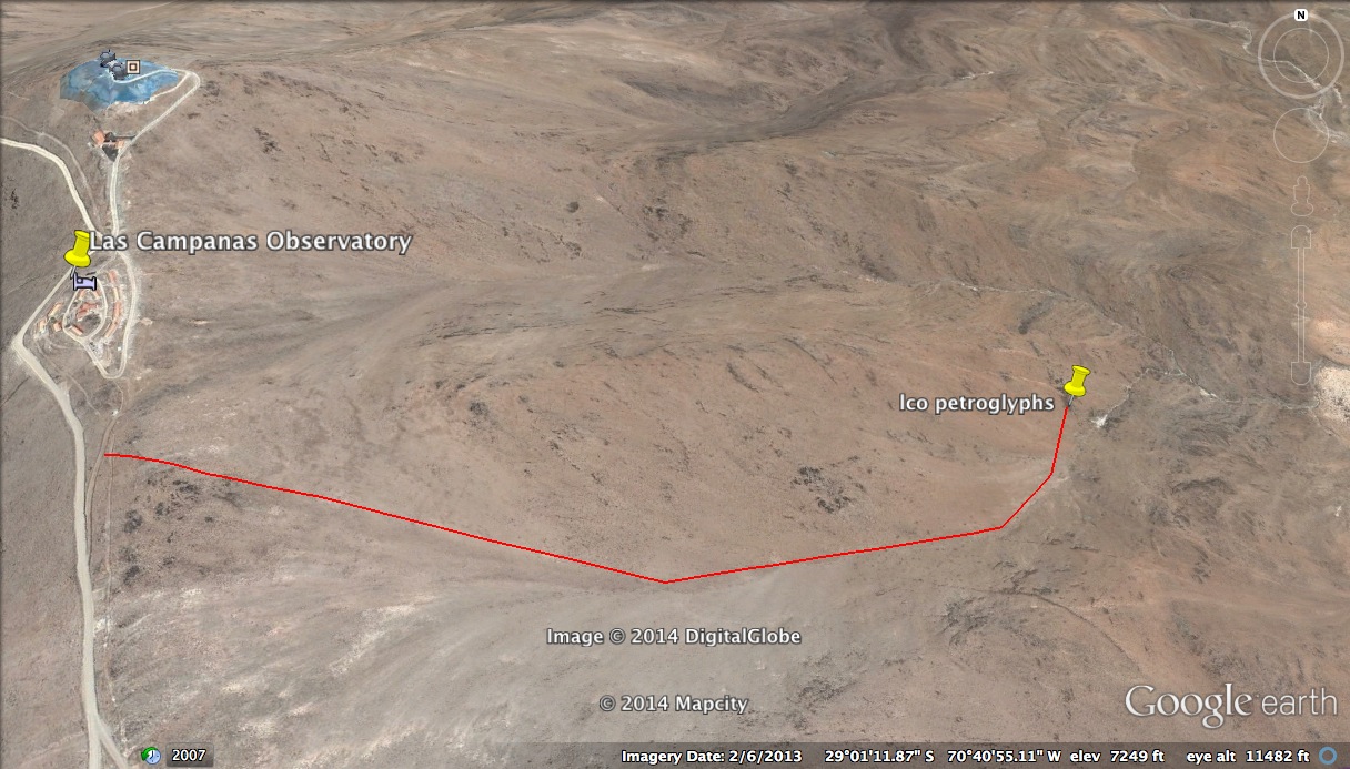
The whole trip shown by the line is about 1.7 km one way. Elevation gain (or loss) amounts to about 400m (1200 feet). It is steeper than it looks on the google earth image, and the way back can be unpleasant, especially when it is hot and dry, so do not forget to take plenty of water and some sun protection. The petroglyphs are best lit early in the morning. The return is easiest if you crawl up in the bed of the creek, or just to the right of it.


click tracking